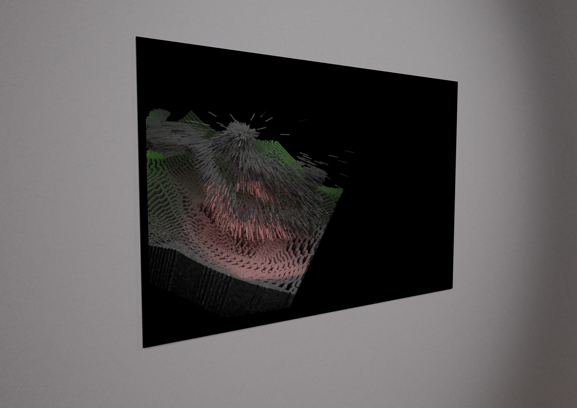
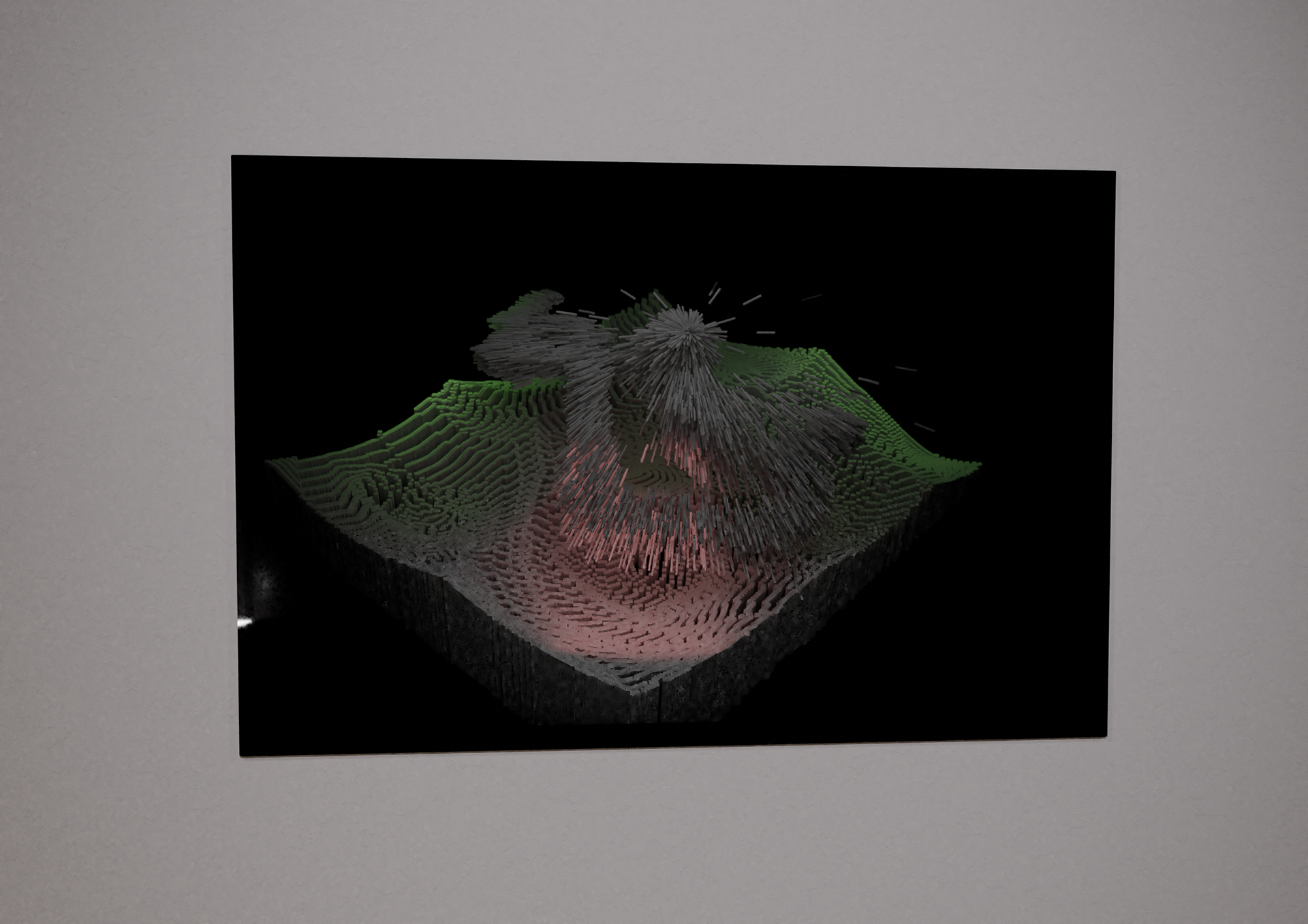
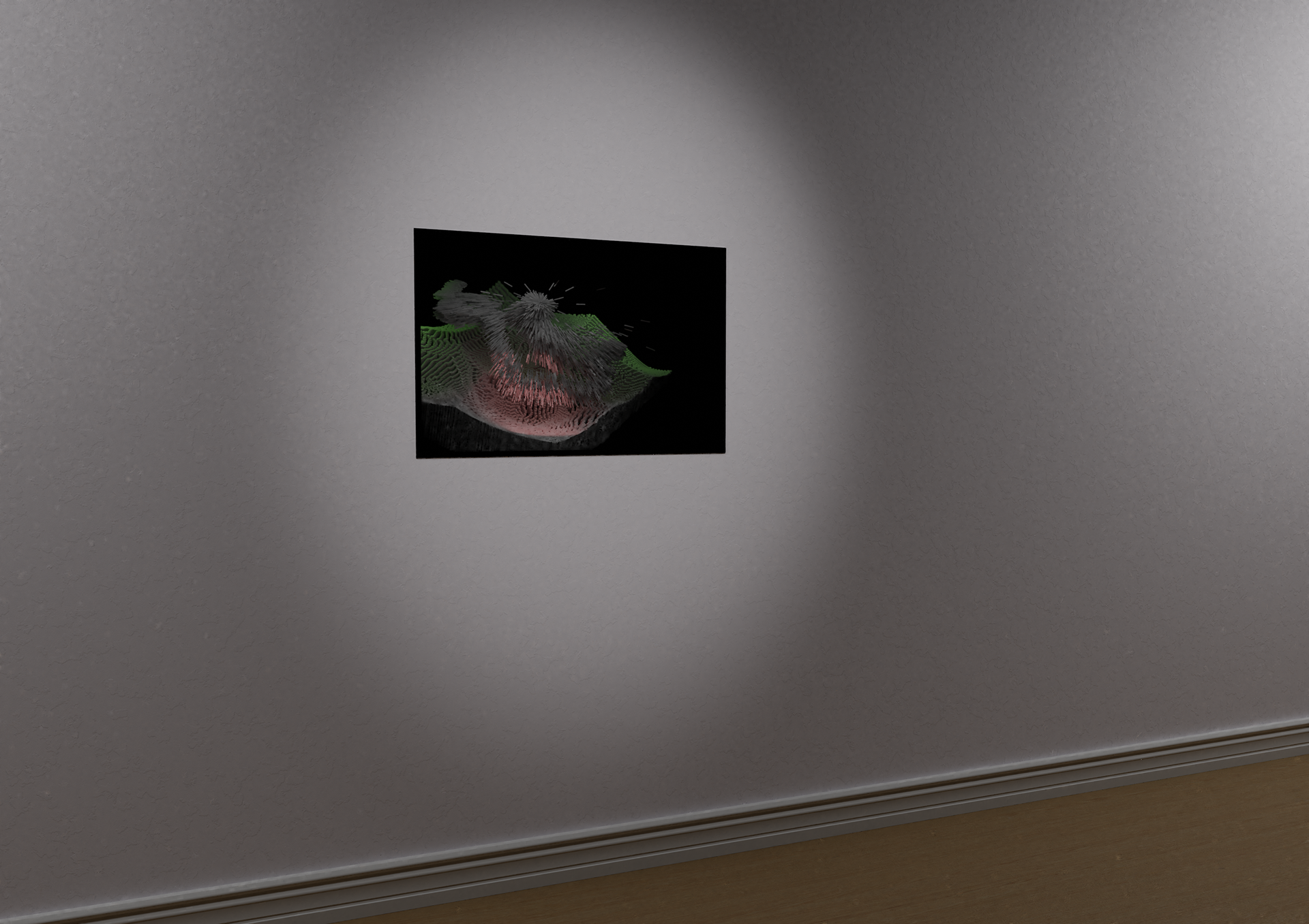
Simulation of gallery installation in 'Art in Holography: Light, space and time',
Museu Da Cidade De Aviero, Portugal. 2018
Museu Da Cidade De Aviero, Portugal. 2018

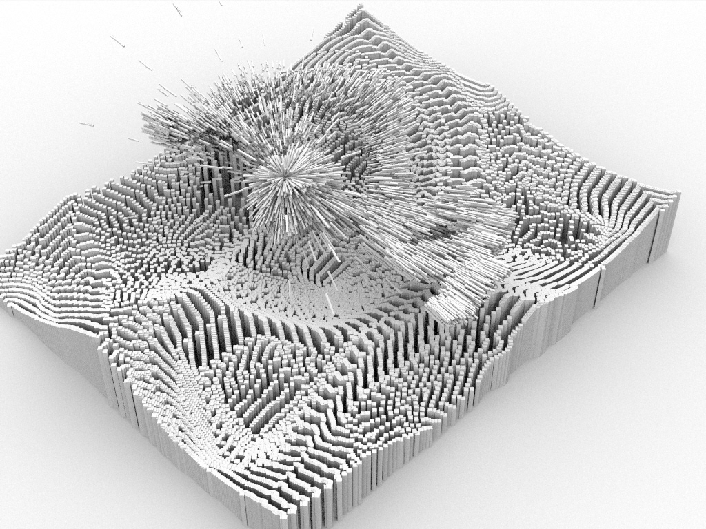
'Governors Island Hologram' . Digital hologram (Photopolymer film and acrylic). 15 x 30 cm. Digital render of artwork. 2018.
'Governors Island Hologram' (detail). Digital holographic rendering of GPS and GSR data.
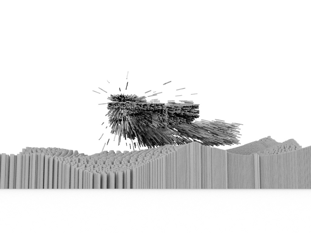
'Governors Island Hologram' (detail). Digital hologram (Photopolymer film and acrylic). 15 x 30 cm. Digital render of artwork. 2018.

'Governors Island Hologram' (detail). Digital hologram (Photopolymer film and acrylic). 15 x 30 cm. Digital render of artwork. 2018.
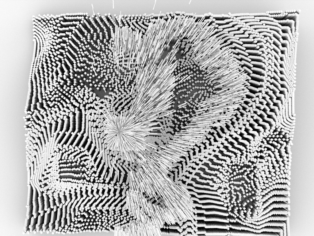
'Governors Island Hologram' . Digital hologram (Photopolymer film and acrylic). 15 x 30 cm. Digital render of artwork. 2018.
'Governors Island Hologram' . Digital hologram (Photopolymer film and acrylic). 15 x 30 cm. Digital render of artwork. 2018. Video illustrates 3D effect of holograms when the viewer moves left to right (parrallax).
Practice-based research process:
Images collected during drone flights
Images collected during drone flights
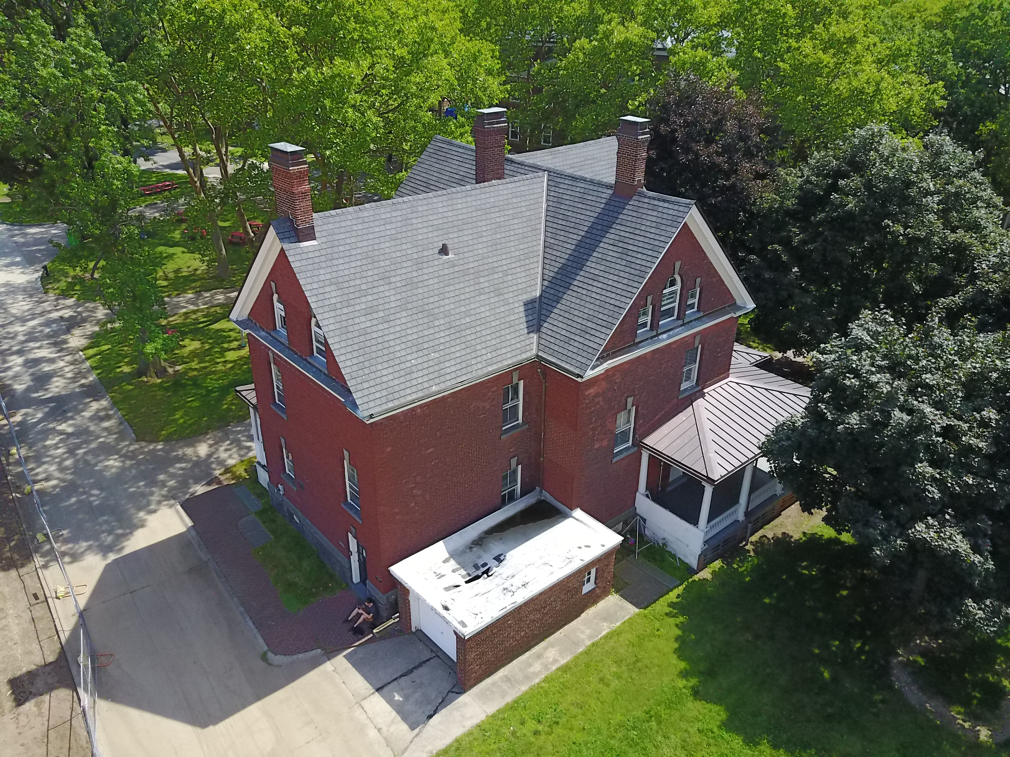
Still from drone flight showing Holocenter building, Governors Island. Drone flights were launched from this location while conducting a 'Light and Space' artist residency in 2017.
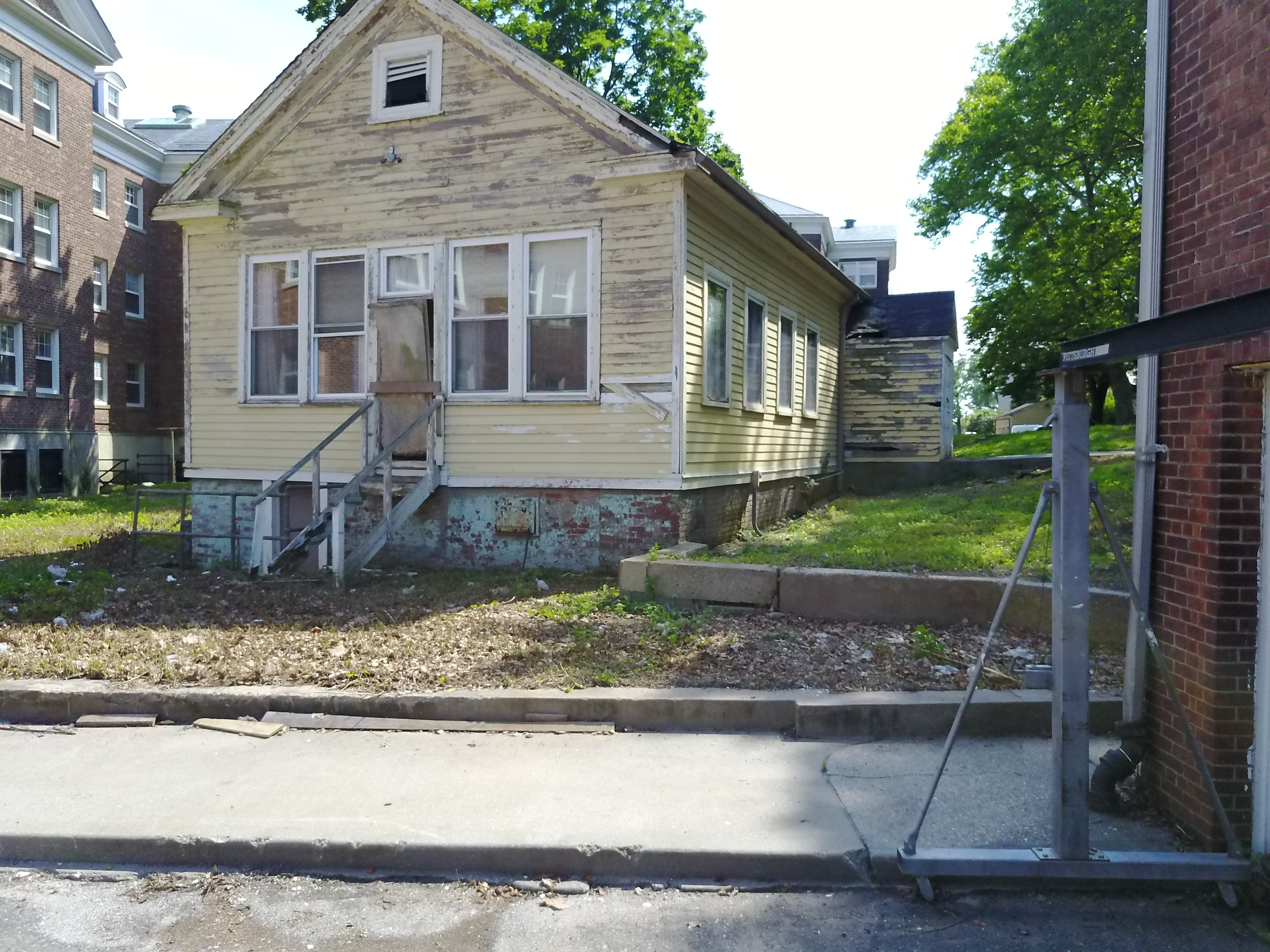
Still from drone flight. Abandoned building in former Coast Guard barracks on Governors Island.
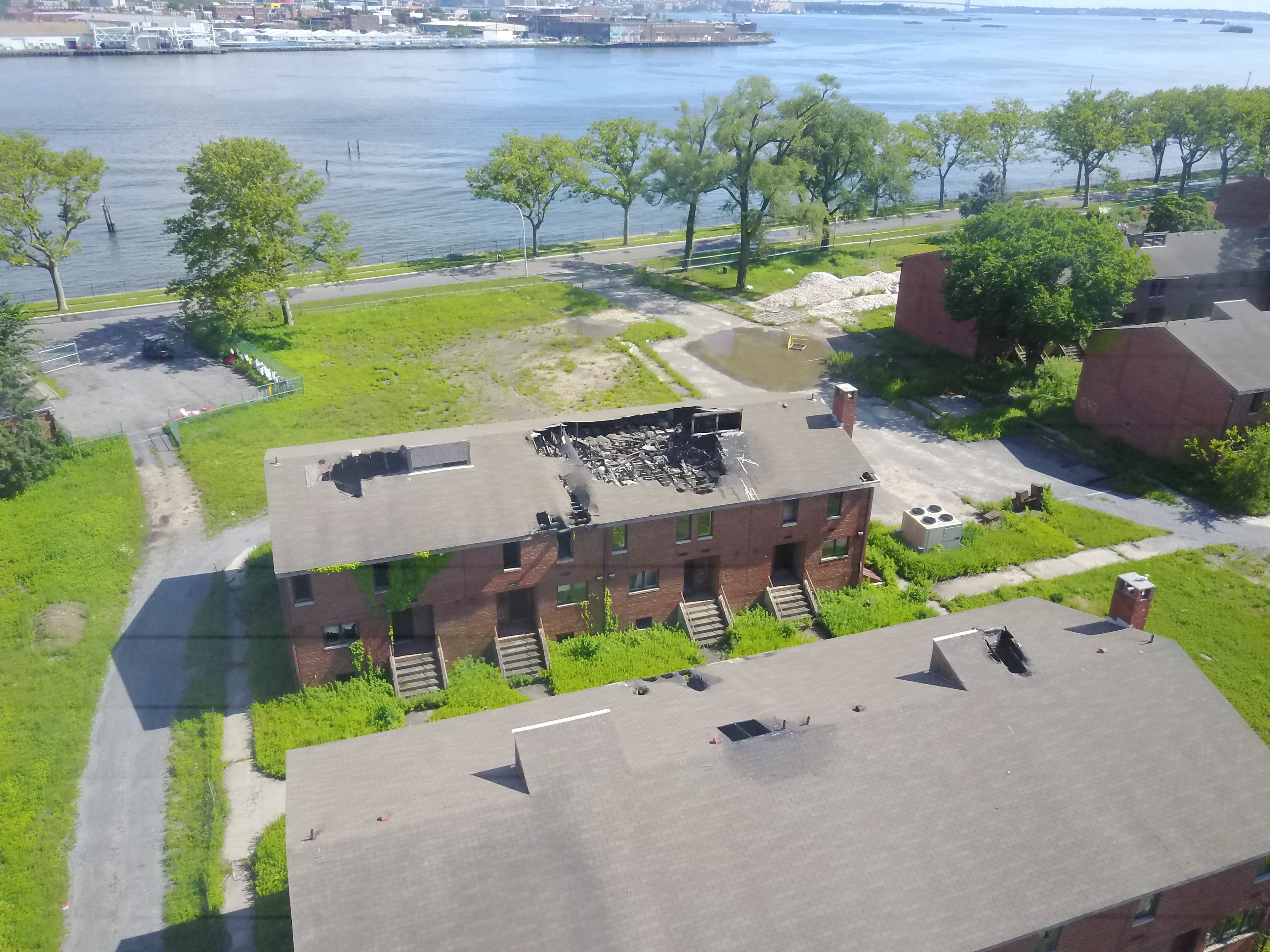
Still from drone flight. Burnt out building in former Coast Guard barracks, Governors Island.
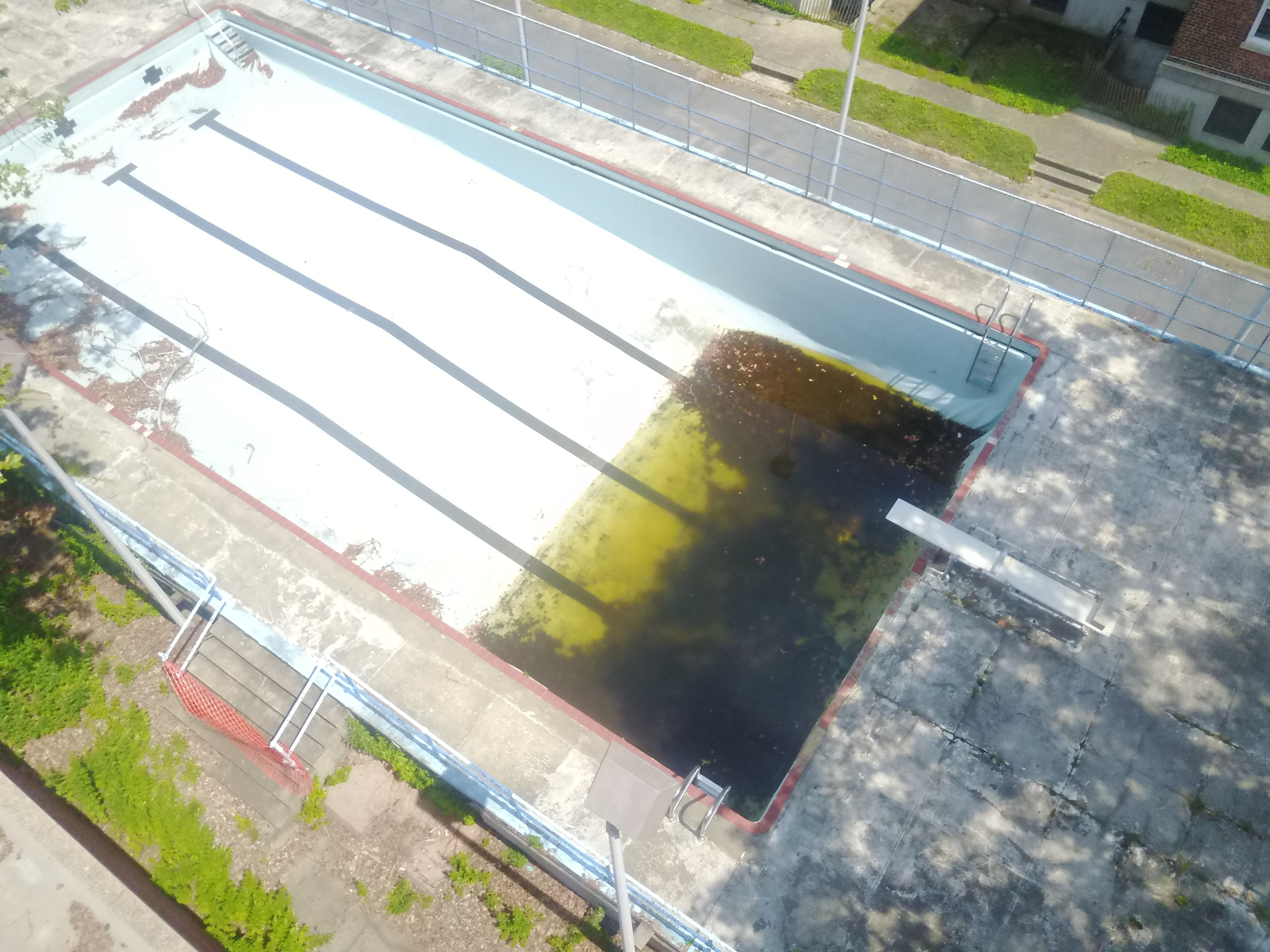
Still from drone flight. Stagnant abandoned pool in former Coast Guard barracks, Governors Island.
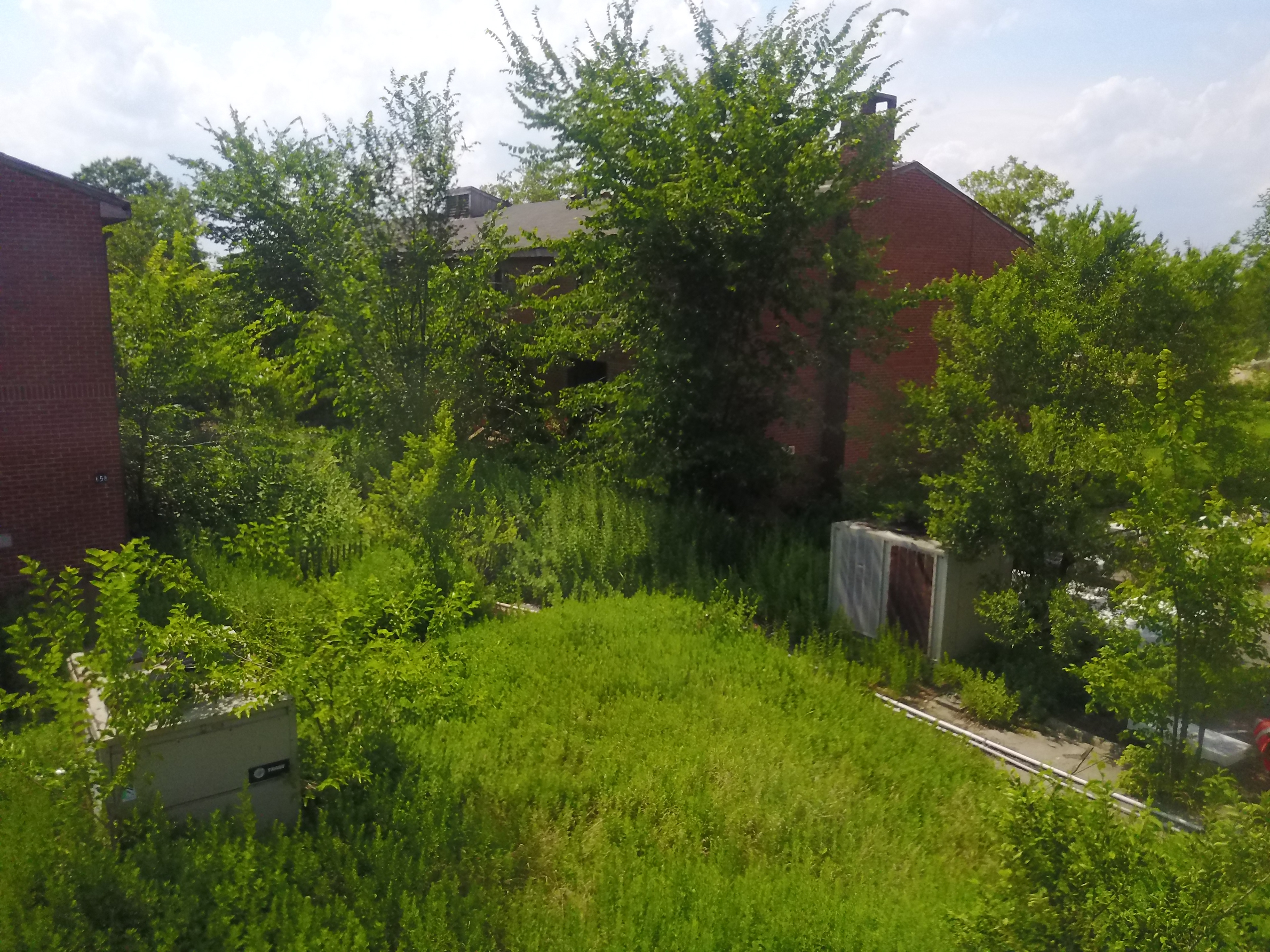
Still from drone flight. Overgrown housing on Governors Island.
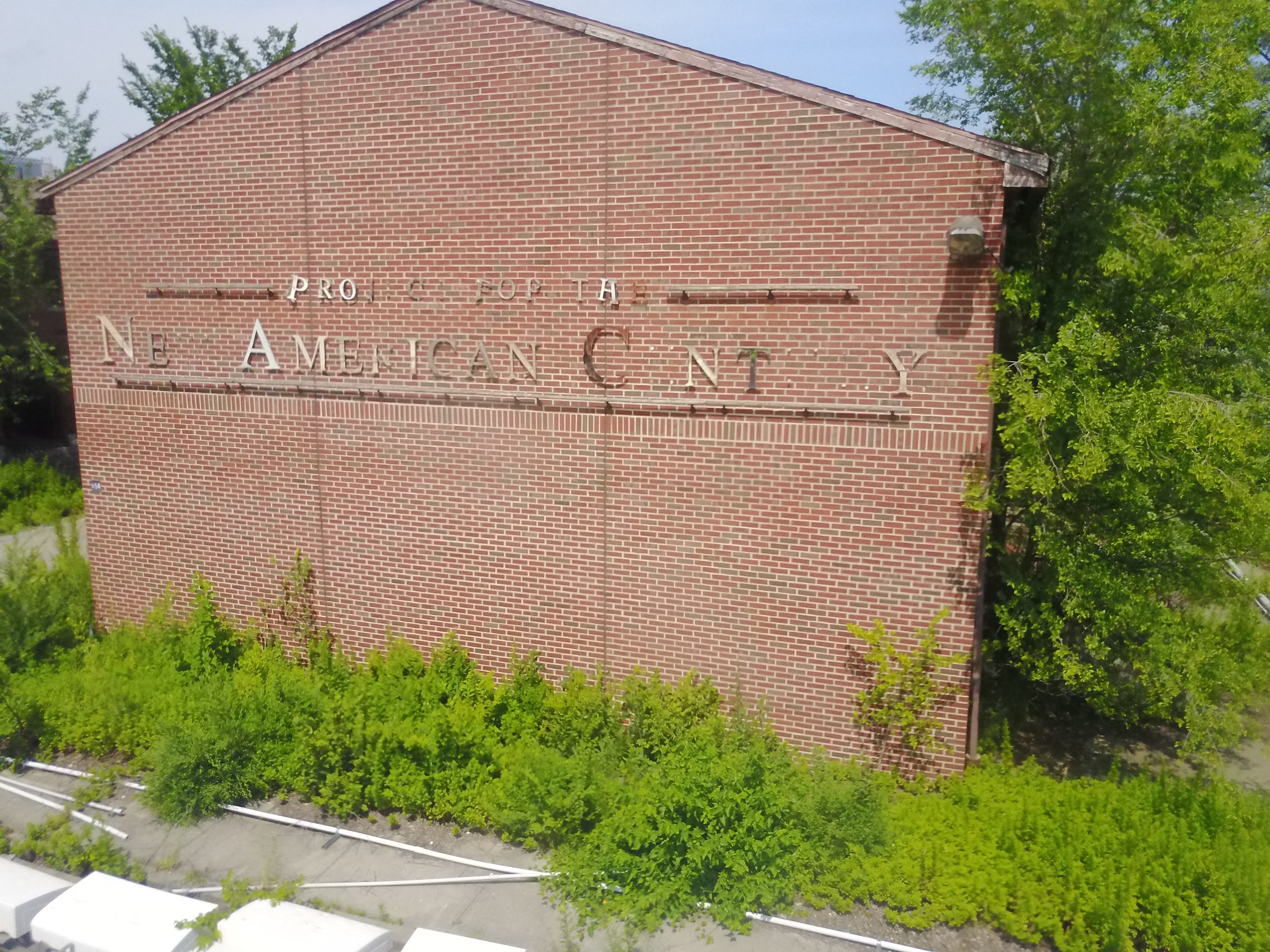
Still from drone flight. Derelict building on Governors Island.
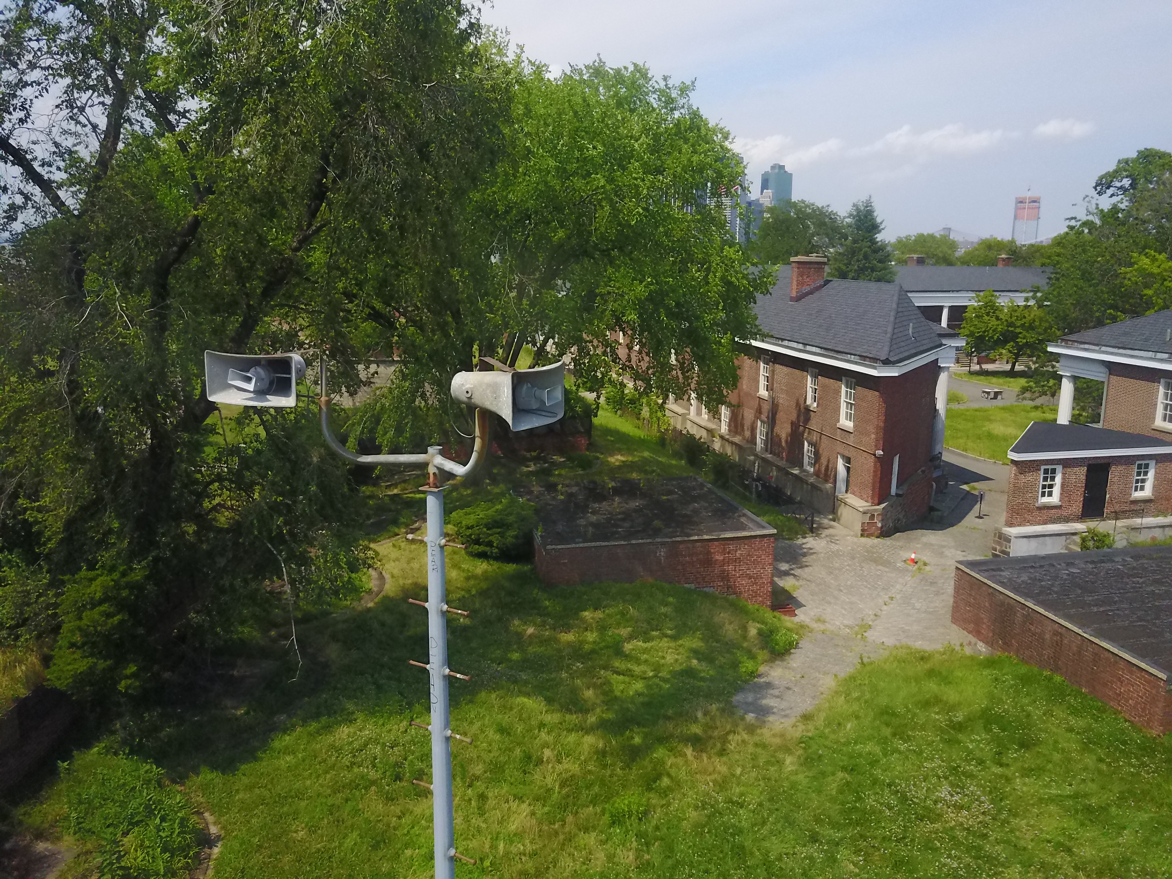
Still from drone flight. Former air-raid sirens at Fort Jay on Governors Island.
Drone flight video documentation
Drone Flight Data (Google Earth Previews)
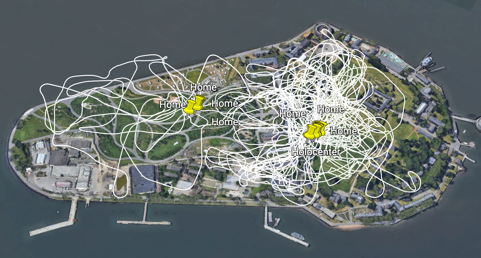
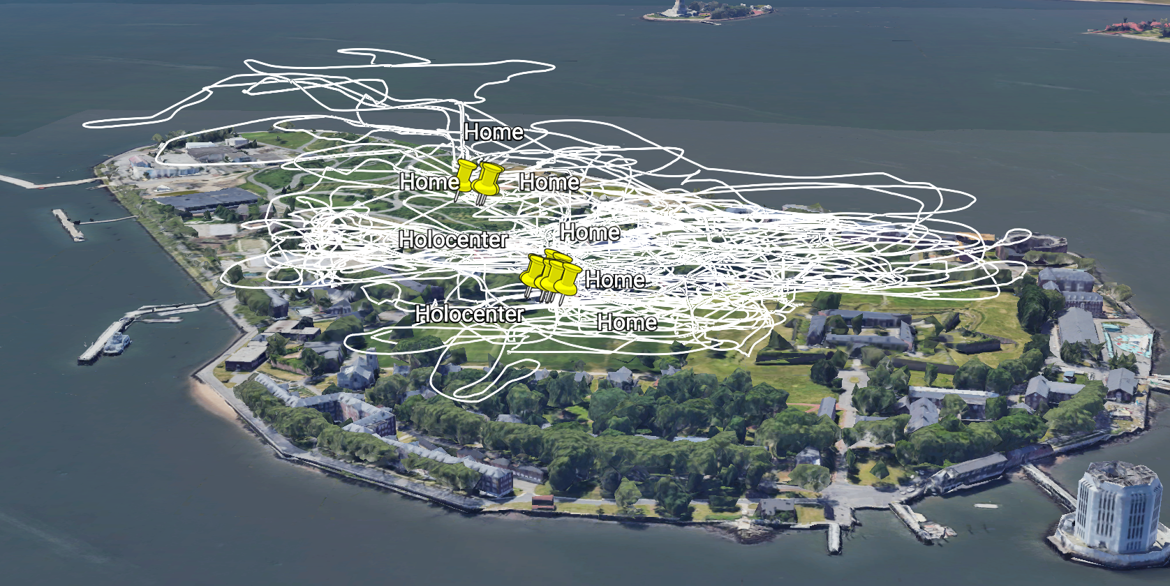
Screenshot showing all drone flights on Governors Island, visualised via Google Earth. Drone flight data is automatically recorded in Keyhole Markup Language (KML), largely for diagnostic/evidentiary purposes when a drone crashes or is used illegally.
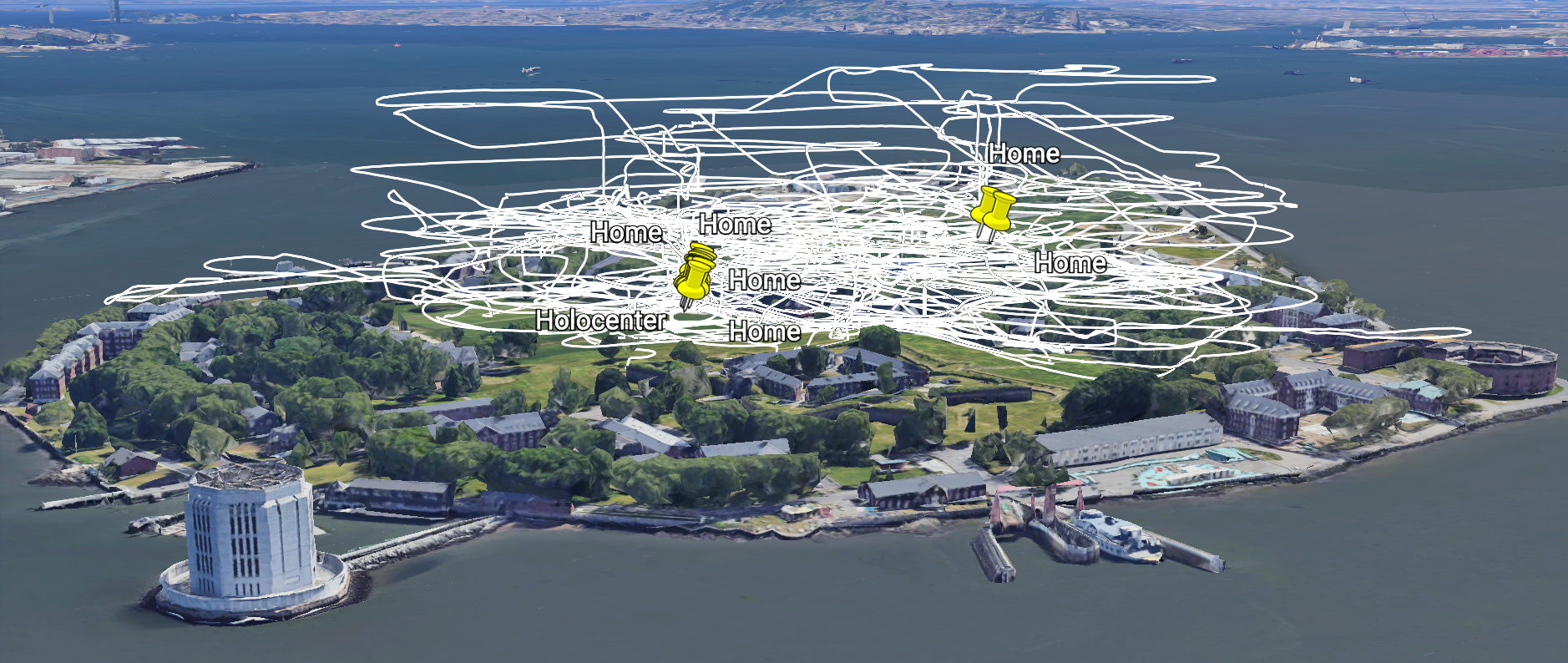
Oblique view showing dense 3D routes of all drone flights visualised via Google Earth. In total, approximately 60 flights were conducted as part of the 'Light and Space' Holocenter residency on Governors Island, New York.
Side view showing dense 3D routes of all drone flights visualised via Google Earth.
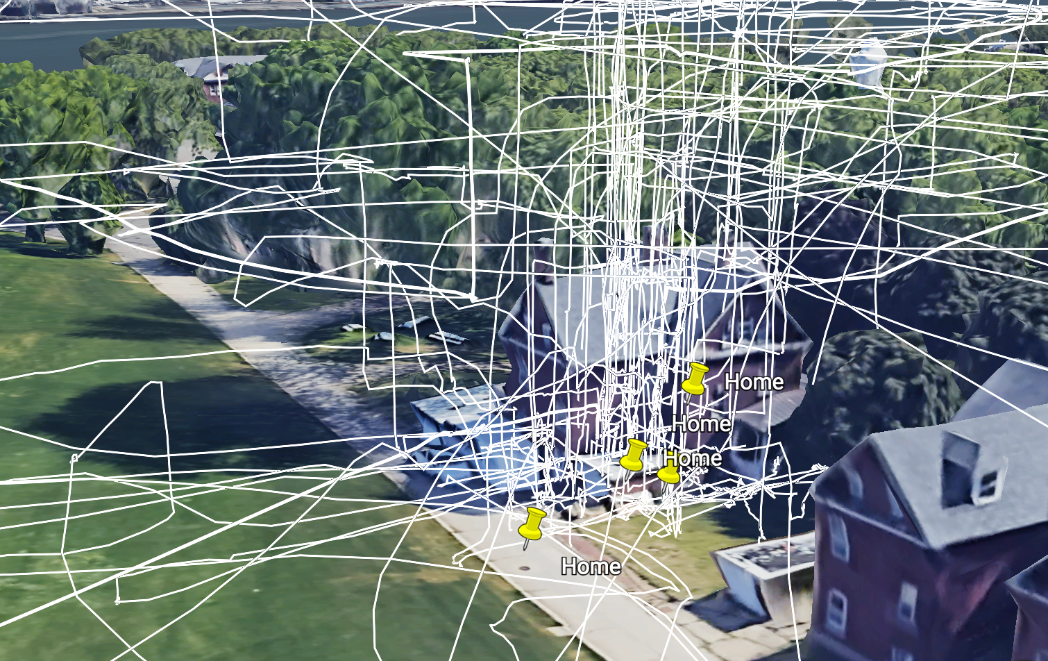
Detail showing drone take-off and landing routes departing from the rear of Holocenter
Detail showing individual drone flight and individual location coordinate points recorded in KML format.
Work In Progress imagery (Rhino/Grasshopper

Experimentation with rendering changes in Galvanic Skin Response (GSR) data as they correspond to drone flight. In this configuration, higher GSR (sweat response) creates larger circles along the drone flight path
Detail of changes in circle size in accordance with GSR data

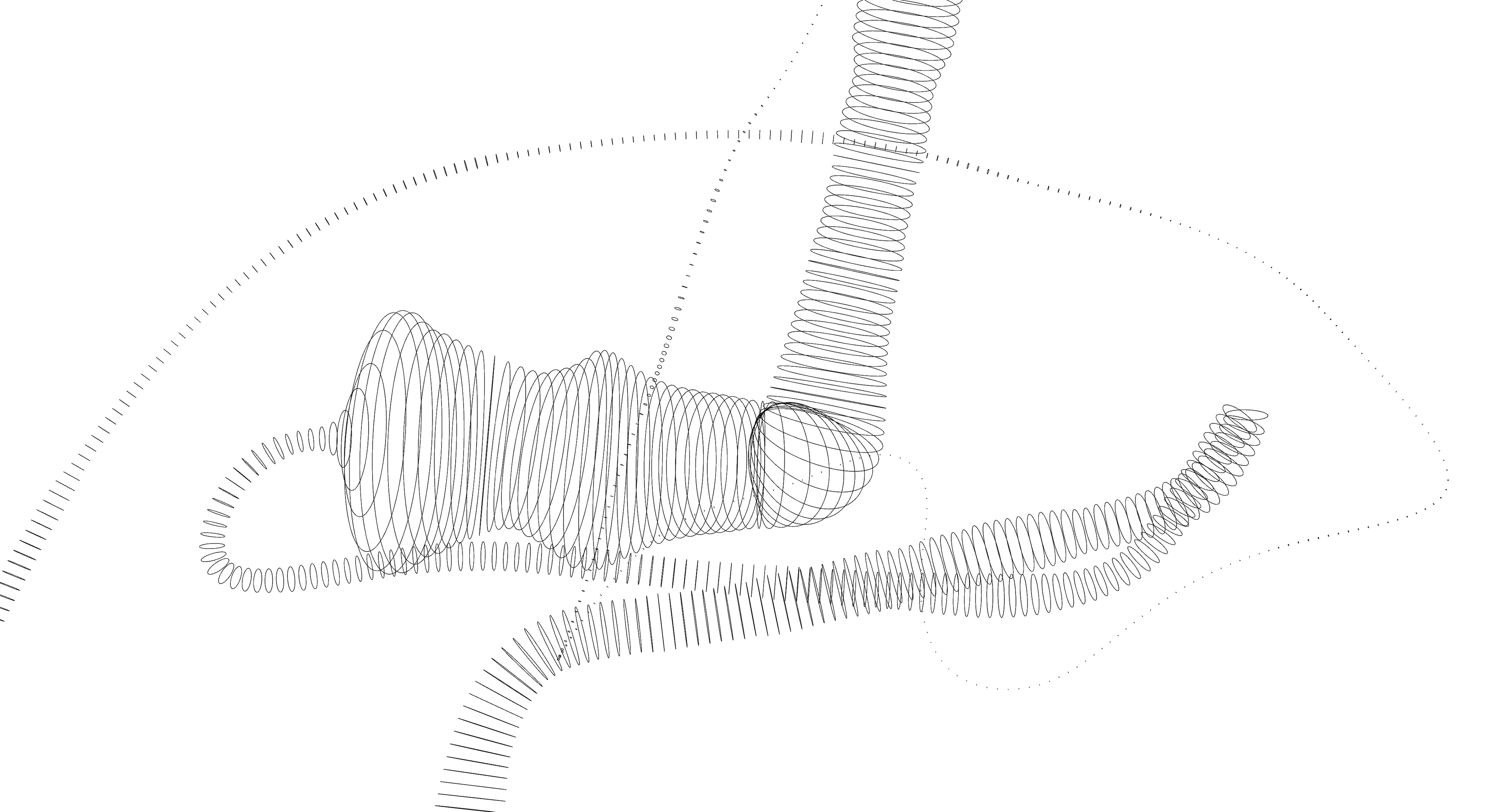
Practice experimentation from side view
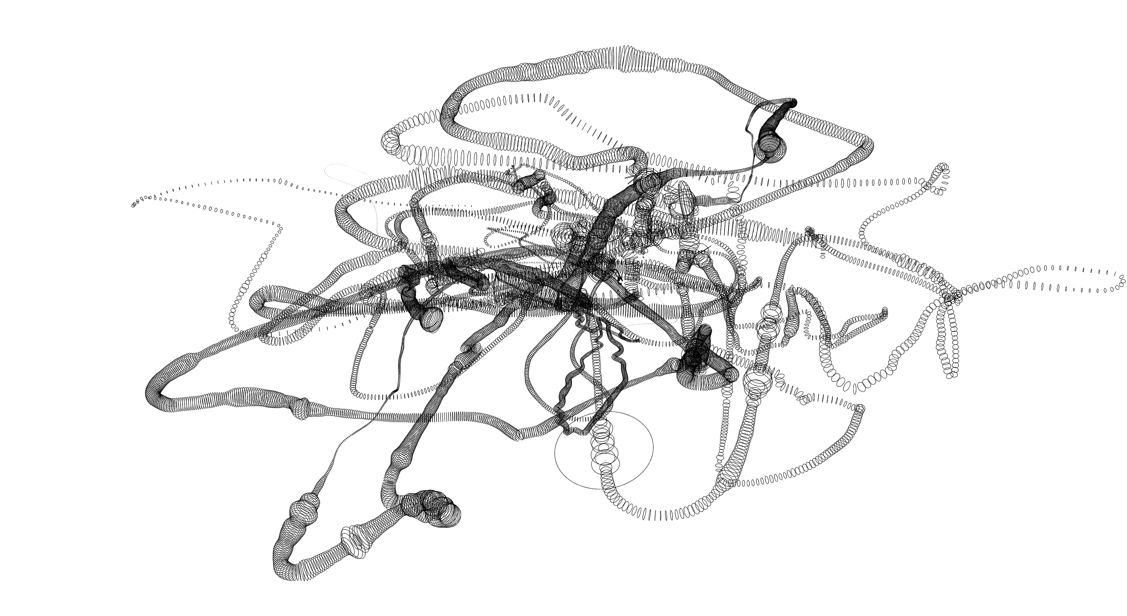
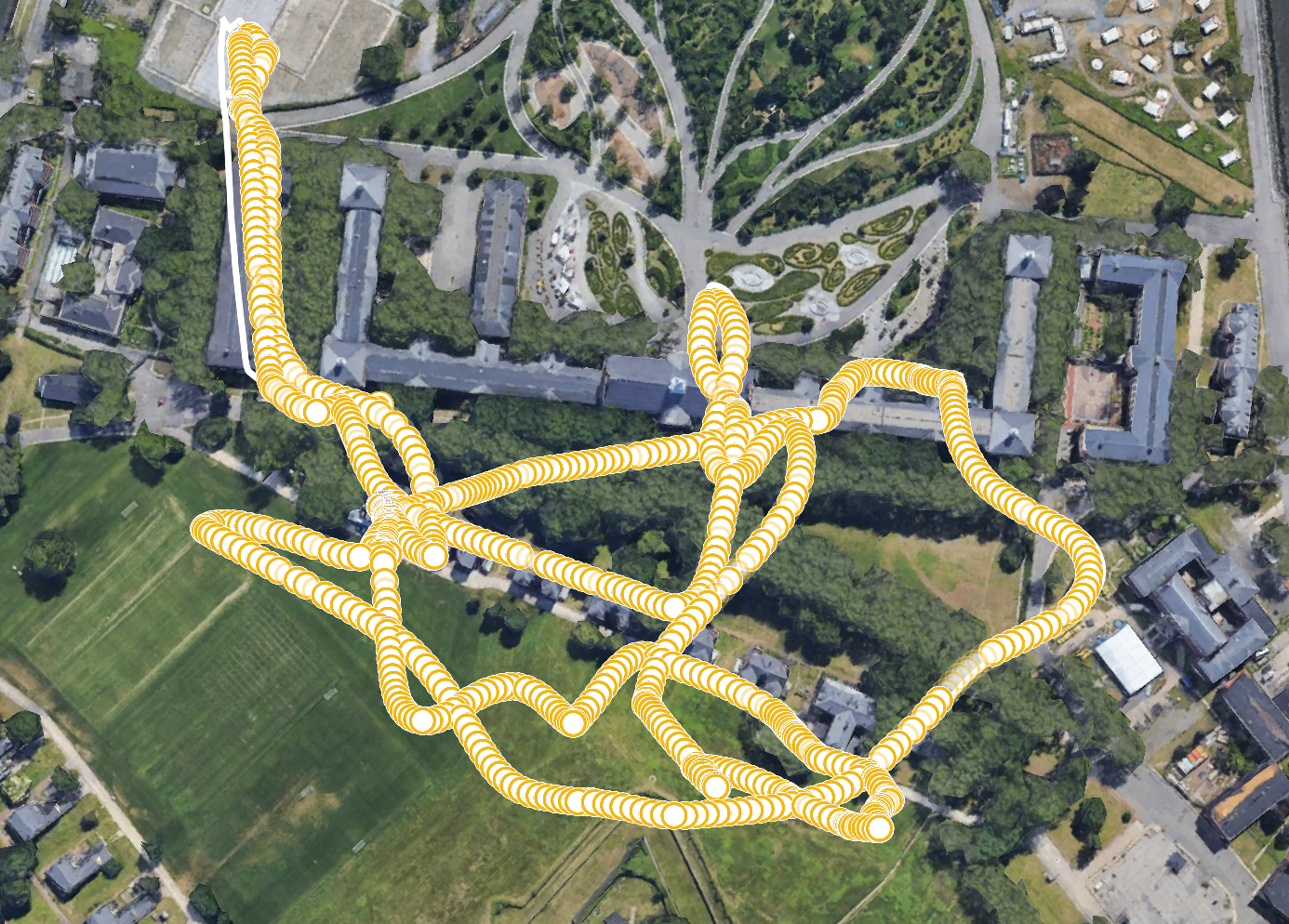
Experimentation combining and rendering 11 drone flights and corresponding GSR data.
Grasshopper workflow
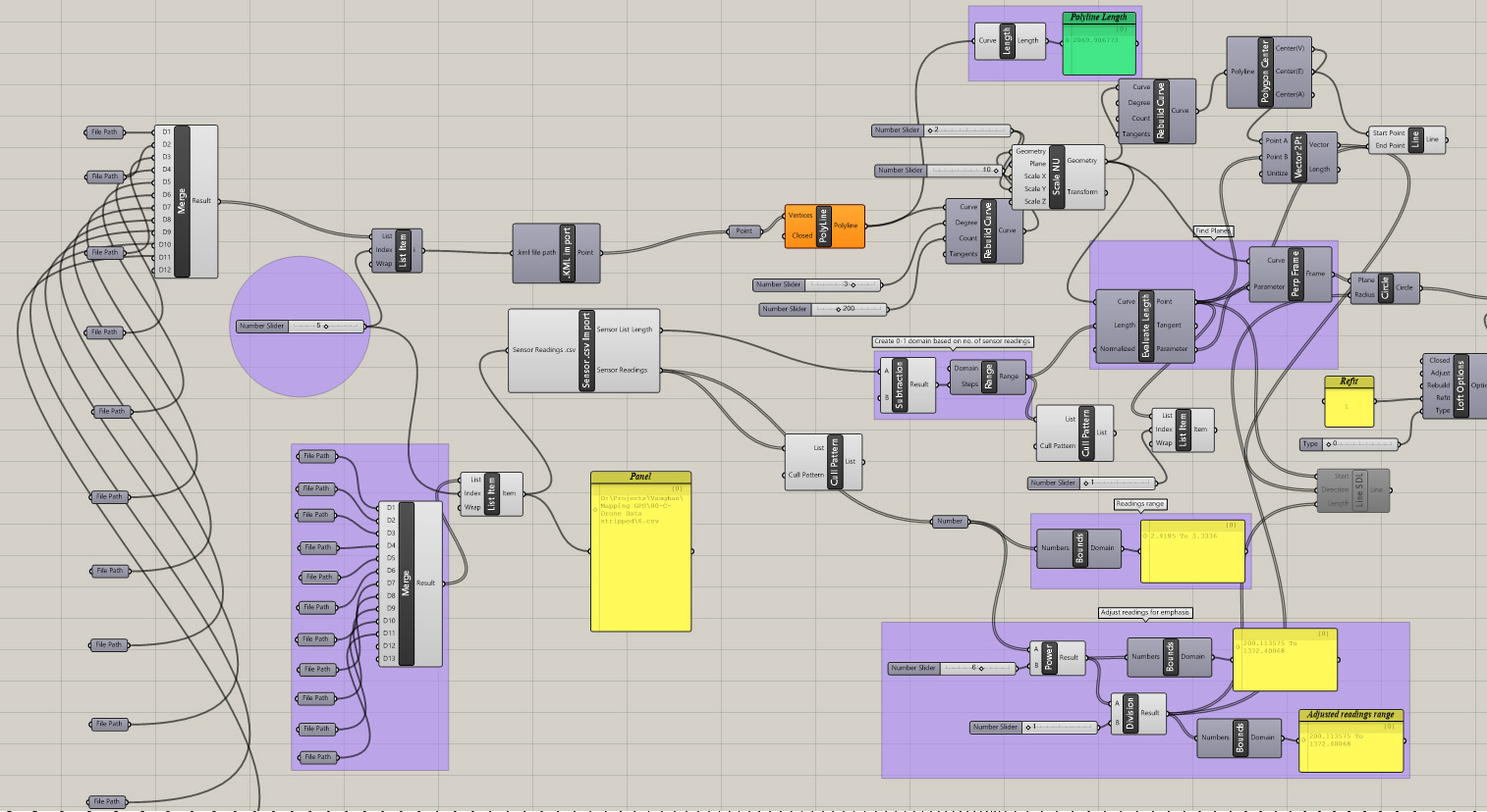
Screenshot of Grasshopper experimentation. This definition was used to convert coordinate values from KML into points in XYZ space in Grasshopper
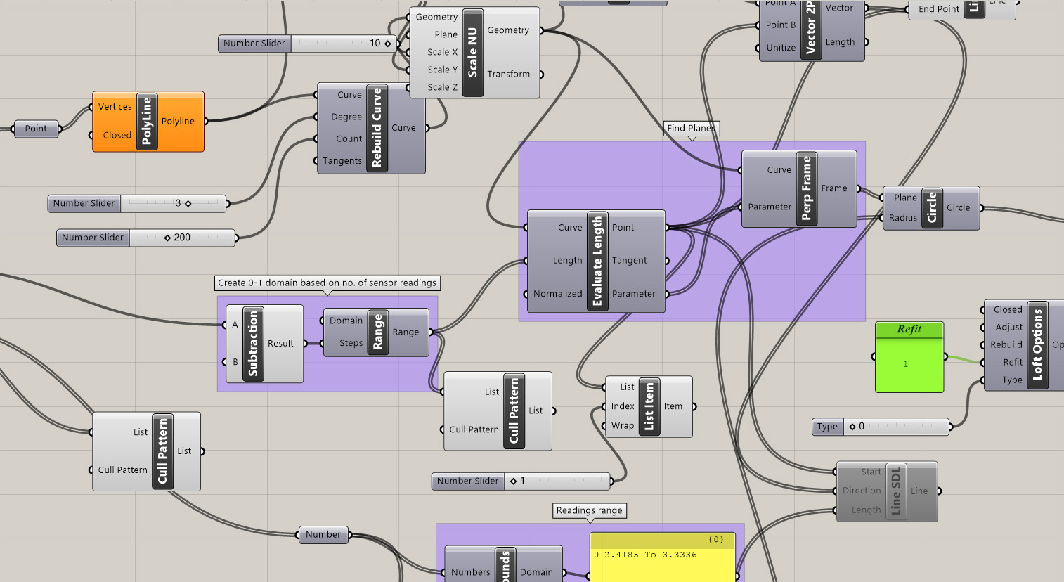
Detail of Grasshopper definition showing relation between GSR readings and reconstructed flight paths from KML flight data
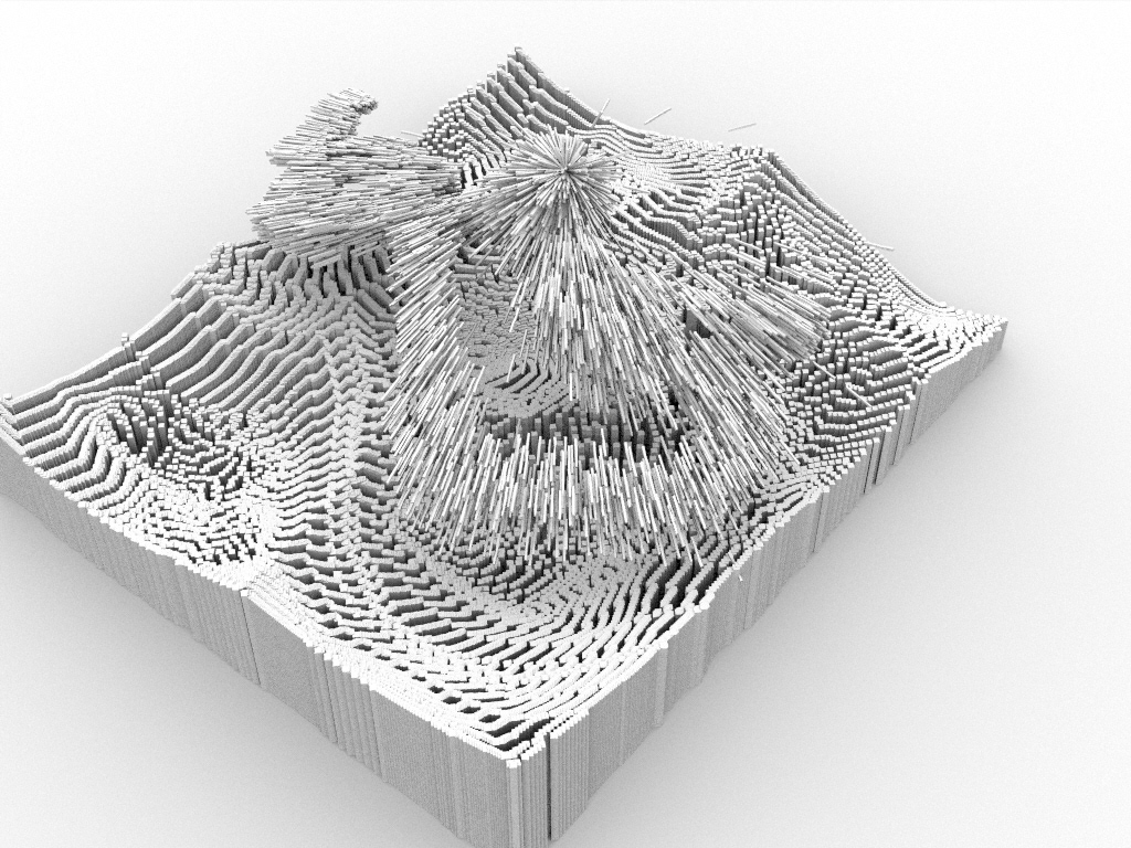
Final renders from Rhino
Rear-view render of final model used in 'Governors Island Hologram'
Side view render of final model used in 'Governors Island Hologram'
Plan view render of final model used in 'Governors Island Hologram'